Fill form to unlock content
Error - something went wrong!
Your content is just a step away. Please submit below.
Thank you!
3D LiDAR Delivers Spatial Intelligence

Picture the last time you were at a concert or a similar large event in the heart of a busy city. You probably struggled to find parking or went through security clearance hassles at the gate. And it was not easy to battle lines at the concession stand or the restroom. Eliminating these annoyances would dramatically improve visitor experiences. It would help event organizers, too.
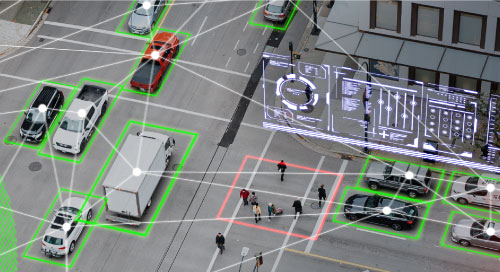
It’s why airports, city governments, and entertainment venues bet on LiDAR (Light Detection and Ranging), a pulsed laser-based technology specially suited to delivering spatial intelligence. Using LiDAR delivers information not just on the numbers of people and vehicles but their flow and interactions. This means that organizers can maintain security and spot and alleviate bottlenecks in real time.
Advantages of 3D LiDAR
“At large infrastructure sites and events, security and crowd management are not easy, but they’re jobs LiDAR is especially good at,” says Raul Bravo, President and Founder of Outsight, leader in 3D LiDAR solutions.
“While most people might think of CCTV and IP video cameras when it comes to monitoring devices, their two-dimensional capabilities are limited for tracking a three-dimensional physical world,” Bravo says. “Unlike traditional computer vision, LiDAR can’t tell if a person is wearing a red shirt or green, but it knows that person’s speed or location—while delivering data as a 3D capture.”
Because of LiDAR’s capabilities, digital twins have been using the technology to obtain data about the physical world for a while now. “What is emerging is using LiDAR technology to not only map the static physical world but to digitize the real-time movement of people and vehicles,” Bravo says.
Also reassuring to organizations is that LiDAR is a natively anonymous solution. Because LiDAR does not capture images but only the distances of things, privacy is baked in by definition. Monitoring crowds without capturing people’s pictures and maintaining privacy is key to meeting a host of governmental regulations.
Because of LiDAR’s capabilities, #DigitalTwins have been using the #technology to obtain #data about the physical world for a while now. @Outsight_tech via @insightdottech
3D LiDAR Data Processing Challenges
While LiDAR has many advantages, processing the resulting data is not easy. Plugging 3D spatial intelligence data into traditional computer vision techniques delivers poor outcomes. Instead, “you have to create specific algorithms and techniques that tackle this specific kind of problem,” Bravo says.
Also challenging is the sheer volume of data that LiDAR generates. “When we deploy LiDAR at some of the biggest airports in the world, we have hundreds of LiDAR units at the same time,” Bravo says. “The data from each is the equivalent of a hundred people streaming Netflix.”
The diversity of designs, models, and manufacturers in the LiDAR space is also a problem. The Outsight platform solves for all these challenges and works with any LiDAR manufacturer or model. The solution develops living digital twins, feeding information about the physical world at a rapid-enough clip—20 times per second—to deliver insights in real time. These insights can route to the right person and take the form of alarm alerts.
Visual-Spatial Intelligence Use Cases
The problems that Outsight can help resolve apply to smart cities, transportation hubs, and international events. If too many people are crowded in airport baggage check-in areas, the solution can alert officials downstream of potential traffic jams in the security lines, which they can then staff for.
For example, the city of Bellevue, Washington, uses Outsight’s LiDAR solution to detect problems with near-miss situations at intersections, when vehicles get too close to bicycles or pedestrians. LiDAR was especially well-equipped to capture such incidents at night. The information has helped the city take more proactive measures such as clearer lane markings to meet its goal of eliminating traffic fatalities and severe injuries by 2030. Outsight LiDAR can also help smart cities address traffic flow problems in real time. For example, if a vehicle uses the wrong lane for merging, a flashing light can alert the driver to remedy the mistake.
When managing the physical flow of people and vehicles on a massive scale, you have to ensure a smooth visitor experience and operational excellence. Key performance indicators like the length of a ticketing line and time spent in one will matter.
At the 2024 Olympics in Paris, Outsight’s LiDAR solution helped with security and crowd management. Outsight was again pressed into service at Tomorrowland, one of the world’s largest music festivals, held annually in Belgium, which attracts hundreds of thousands of attendees.
The Technology Infrastructure for Spatial Intelligence
Spatial intelligence is about digitizing the physical world and creating insights out of it. Achieving this requires processing power that can handle large amounts of data with efficiency. Outsight depends on Intel products and technologies to deploy its solutions at scale.
“You need specific and highly efficient software algorithms that use CPU-based and not GPU-based solutions for energy efficiency,” Bravo says, which is what Intel CPUs deliver.
As for the future, Bravo is excited about the many possibilities—beyond smart cities, airports, and venues—for the digitization of the physical world. “You can have access to a wealth of unique insights and intelligence that was not even imagined before,” Bravo says. “We are entering a new world of digital transformation.”
This article was edited by Georganne Benesch, Editorial Director for insight.tech.